King Salman ParkExecutive Consultancy Services For Landscape Masterplan And Detailed Design
Le projet
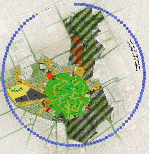
The King Salman Park Foundation commissioned a joint venture comprising Gerber Architekten International, Buro Happold and setec to design King Salman Park, a 17.2 km² park in the center of Riyadh. It comprises 52 sub-projects. The park is part of the Green Riyadh and Riyadh Sustainability initiatives.
Gerber heads the architecture and landscape design departments. Buro Happold and setec provide engineering services.
Nos missions
setec’s missions include :
- Geotechnical studies and design of the park’s dry and wet networks (utilities).
- Design outside the “Innovation Loop” zone
- Design direction for several buildings such as: open-air cinema, amphitheatre, shade structures, overhangs, hypostyle terraces, pedestrian underpasses, etc.
- Project management within the joint venture
– Document control
– Change management
– Risk management
– External interfaces management
– Scheduling
– Reporting
– Quality management
– GIS interactive maps and dashboards (work breakdown structure, topography, risks, interfaces, project progress, utilities, surveys)

Nos expertises mobilisées
Pour aller plus loin
Setec a mis en place une solution SIG dynamique caractérisée par une plateforme web interactive et intégrée dédiée au projet, mise en œuvre via ArcGIS Enterprise.
Cet outil, édité par ESRI le leader mondial des technologies SIG, répond à nos besoins de sécurisation et de partage de données spatialisées. Il offre des fonctionnalités très utiles et ouvre des opportunités pour en faire un outil de support pour toutes les disciplines de l’ingénierie. De plus, il permet le suivi et le reporting des thèmes du PMO : périmètre des travaux, avancement des projets, interfaces afin de faire de cette plateforme un outil d’aide à la gestion de projet utilisé quotidiennement.
Avantages de la plateforme SIG
– Les informations sont partagées entre tous les partenaires et actualisées dans un outil dynamique
– L’information spatialisée permet une meilleure compréhension et révèle les conflits entre les disciplines et les tâches
Découvrir d'autres réalisations
February 2003
The rapid deterioration in traffic conditions on the Cape Verde peninsula (Dakar region) in ...
January 2010
Since January 2010, the Setec Group, together with Bernard Reichen Architecte Urbaniste and ...
LGV Bretagne Pays de la Loire
April 2011
The Bretagne – Pays de la Loire High-Speed Line (LGV) project is an extension of the LGV ...


